This software inserts and remove the tags exif latitude, longitude and altitude in jpeg, tiff and png images performing the geo-positioning of images, it uses tracklogs of GPS devices.
Features
- Handles tags EXIF / IPTC in images: jpeg, png, tiff, pgf, psd.
- Add latitude, longitude and altitude to images files.
- Remove latitude, longitude and altitude from images files.
- Positioning geographically imagens using tracklogs GPS.
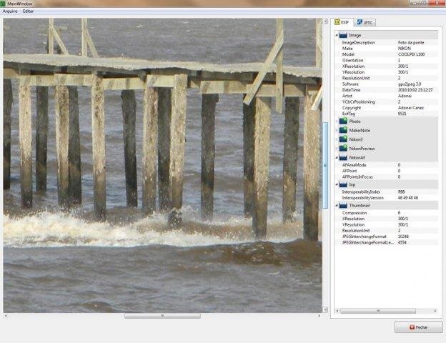
- Show all EXIF, IPTC and XMP informations.
Project Samples

Categories
Metadata EditorsLicense
GNU General Public License version 3.0 (GPLv3)Follow gps2jpeg
Other Useful Business Software
Skillfully - The future of skills based hiring
Skillfully transforms hiring through AI-powered skill simulations that show you how candidates actually perform before you hire them. Our platform helps companies cut through AI-generated resumes and rehearsed interviews by validating real capabilities in action. Through dynamic job specific simulations and skill-based assessments, companies like Bloomberg and McKinsey have cut screening time by 50% while dramatically improving hire quality.
Rate This Project
Login To Rate This Project
User Reviews
Be the first to post a review of gps2jpeg!
